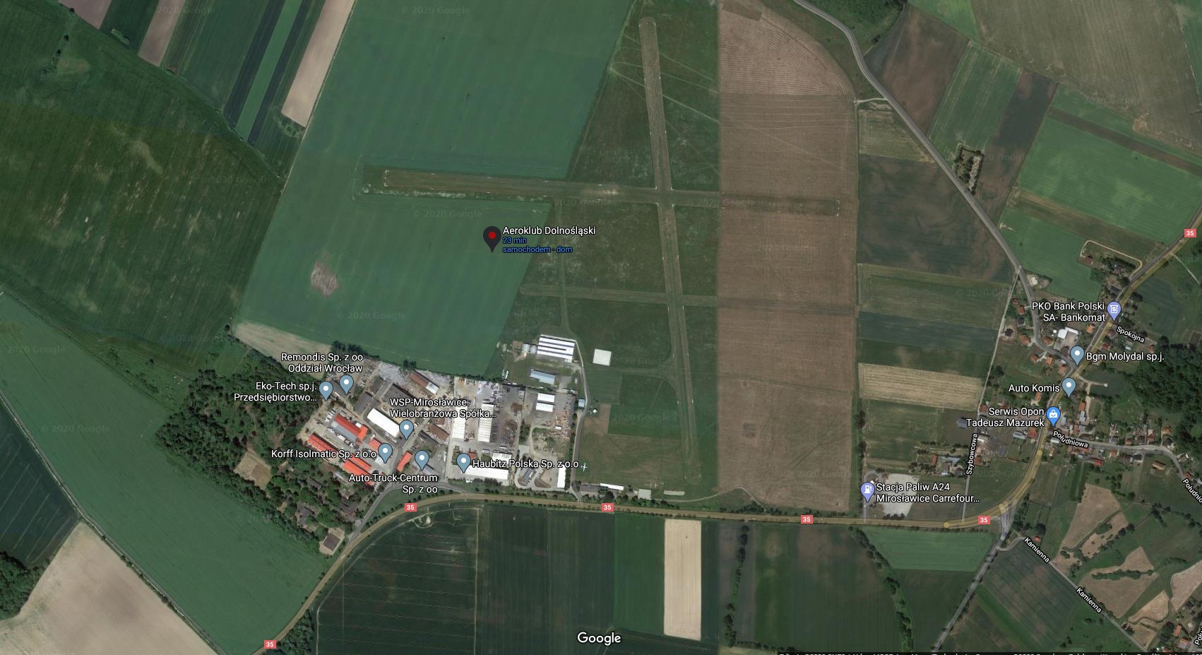
AIRPORT:
Miroslawice Airfield EPMR
Status - Registered airfield
Coordinates / Coordinates - N50°57'33.0" E16°46'07.1"
Radio - Miroslawice-Radio 122.6
Elevation / Elevation - 561 ft
RWY:
- 094/274 (09/27), 968 x 32 m, N50°57'33.0" E16°46'07.1"
- 174/354 (17/35), 968 x 30 m, N50°57'29.1" E16°46'13.5"
AIP - https://www.ais.pansa.pl/vfr/aip.html
There is a possibility of refuelling with Avgass after previous contact by phone and with gasoline at a petrol station located 300m from the airport.